Onshore Archaeology
Archaeology is an important part of our landscape and heritage and one that we are excited to explore and share with local communities as the DBS projects progress.
In 2021, we engaged AOC Archaeology Group to investigate how land within the projects’ onshore development area has been used throughout the ages. Insight gained from their investigations helps us to avoid significant areas of archaeology, be well-prepared to investigate archaeology that we do encounter and to share new discoveries with the local community and beyond.
The investigations began with a geophysical survey of the proposed onshore development area from landfall at Skipsea along the onshore export cable route to the onshore converter stations. This was followed by two seasons of archaeological trial trenching. We are planning further phases of trial trenching in 2025 and 2026.
The work undertaken to date has revealed humans have been active in the area throughout a broad range of time.
Pre-history
At the landfall area at Skipsea, evidence suggests that after the last Ice Age (about 10,000 years ago), the prehistoric landscape of Holderness was punctuated by small damp hollows and ponds, many of which served as focal points for human activity.
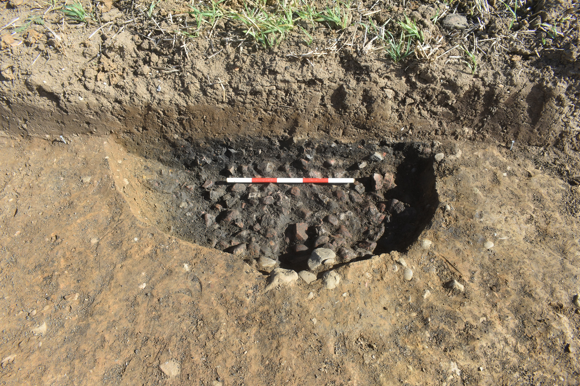
Small pits were discovered in the vicinity of the hollows and ponds, including a fire-pit containing burnt residues, and samples from some of the features were dated to the late Neolithic (3000-2500 BC) and the early/middle Bronze Age (2500-1100 BC). It is likely that humans were using the ponds at this time as sources of water and other resources, and as convenient locations to dispose of waste products.
Along the cable route, linear ditches and gullies were identified that are likely to be Iron Age (700 BC – 43 AD). These were probably field boundaries, similar to the hedges, drystone walls and fences we use today, marking out and draining plots of land for arable and pastoral farming. People living in the area used the ditches to dispose of domestic waste and many of those investigated contained broken pottery, animal bone (food waste) and fired clay.

A Bronze Age fire pit at the proposed landfall site (Skipsea)

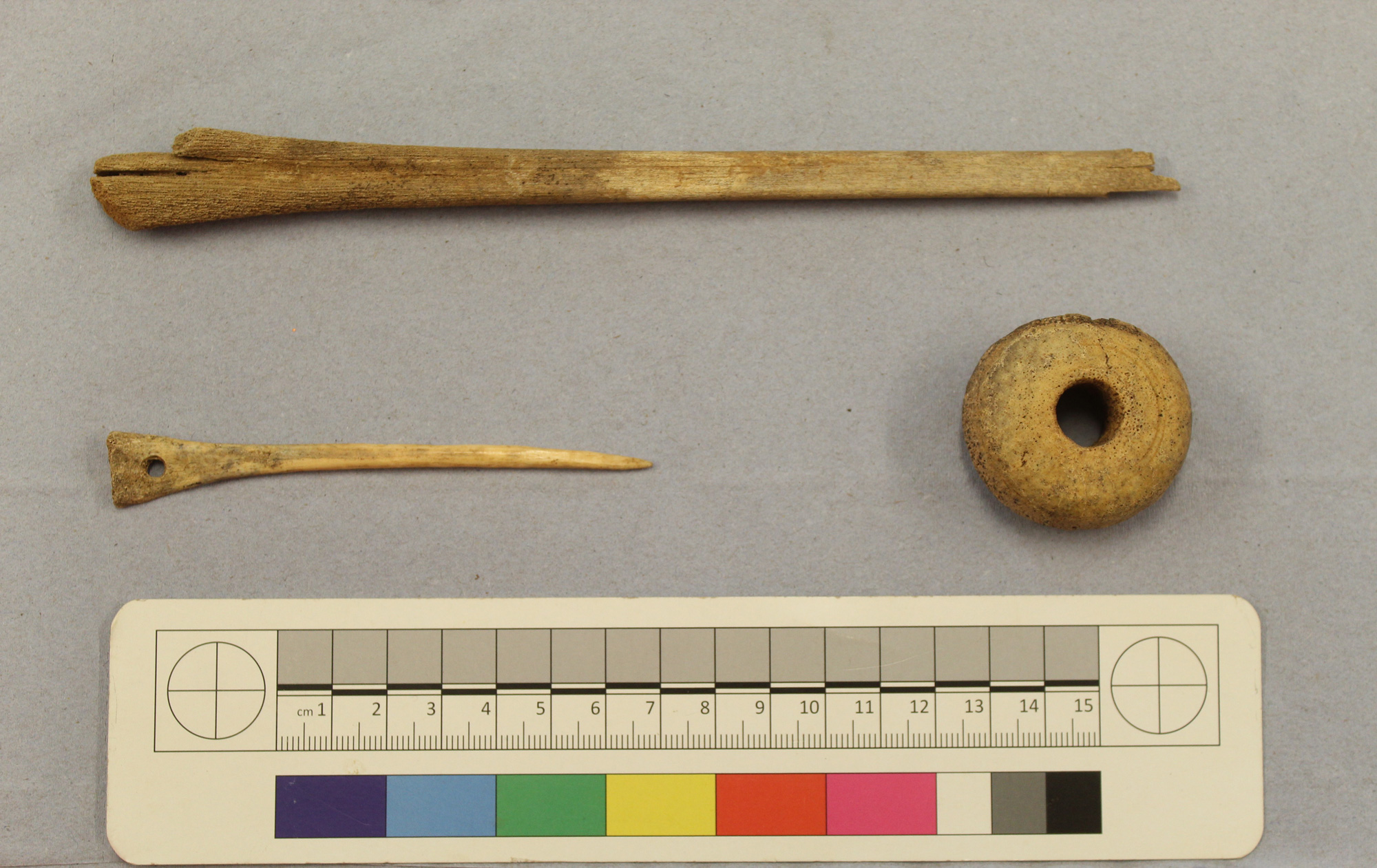
Iron Age/Roman worked bone finds from excavations near Catfoss including pins and a spindle whorl.
Romans
At the site of the proposed converter stations near Bentley, a well-preserved Roman trackway defined by two large parallel ditches, together with associated enclosures and pits were investigated.
The trackway likely enabled access to fields and supported communication between settlements. The ditches contained Roman pottery fragments from beakers, jars and bowls broadly dated to between 2nd and 4th century AD. They also contained bones from sheep, pigs, cattle and red deer plus residues from crops of wheat, spelt, oat and barley giving a fascinating insight into the lives and diet of rural Roman communities in East Yorkshire.
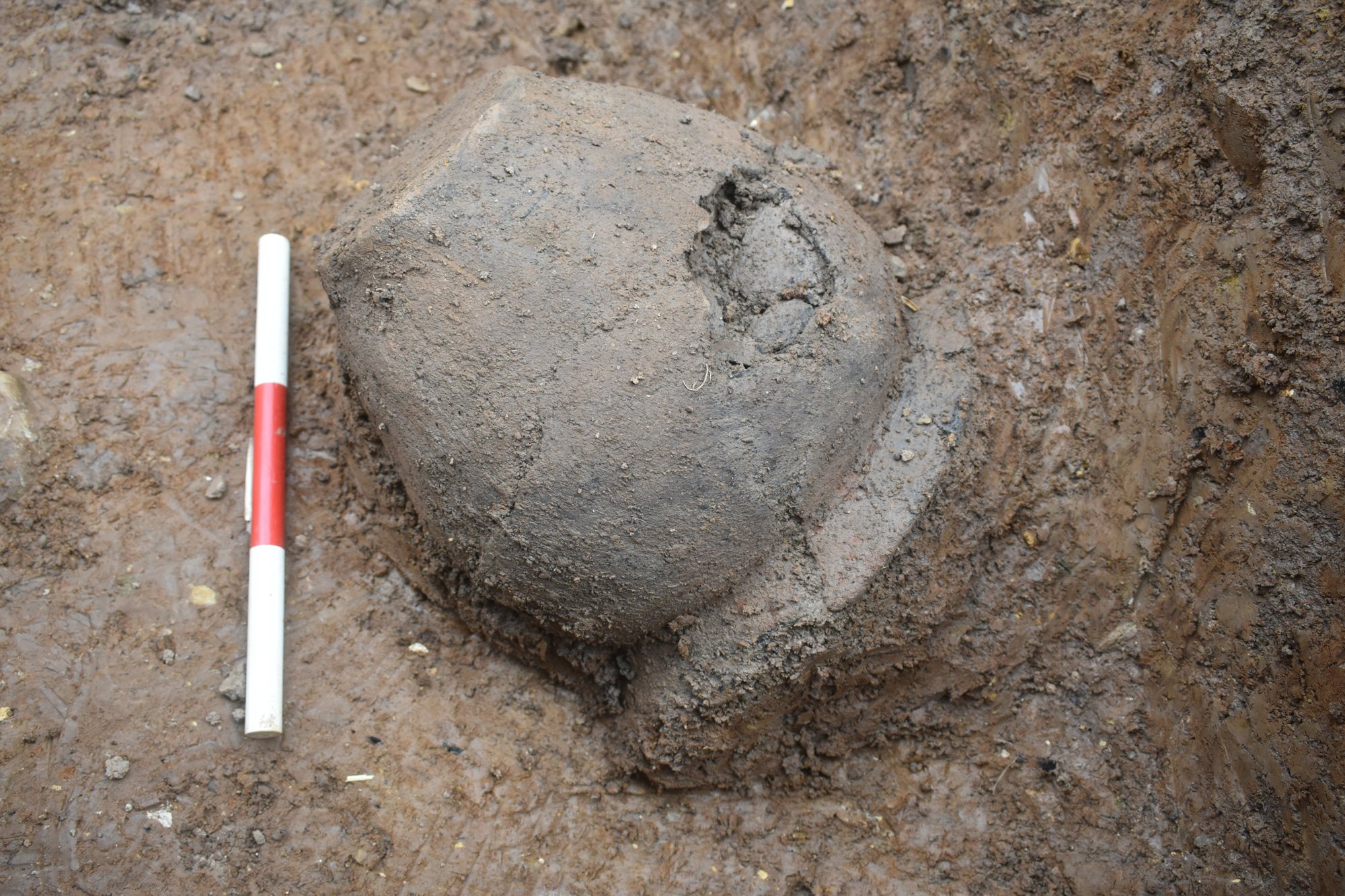
In the area of landfall at Skipsea, another Roman trackway was identified which produced over 700 pieces of pottery from its backfilled ditches, including a nearly-complete large jar. Nearby, at Catfoss investigations took place at a Roman settlement enclosure defined by ditches containing pottery and animal bone including a worked bone needle and spindle whorl used in textile production.
The finds from both these sites suggest a settlement would have been nearby.

Large Roman trackway ditches at Bentley.

A whole pot discarded into a Roman ditch at the proposed landfall (Skipsea)
Early Medieval
One feature was recorded dating from the time immediately after the Roman period - a stone-lined hearth at Bentley with charcoal residue that was radiocarbon dated to the 5th or 6th centuries AD. The hearth alone doesn’t indicate a settlement but someone did set a fire at that location, perhaps to cook a meal.
Medieval
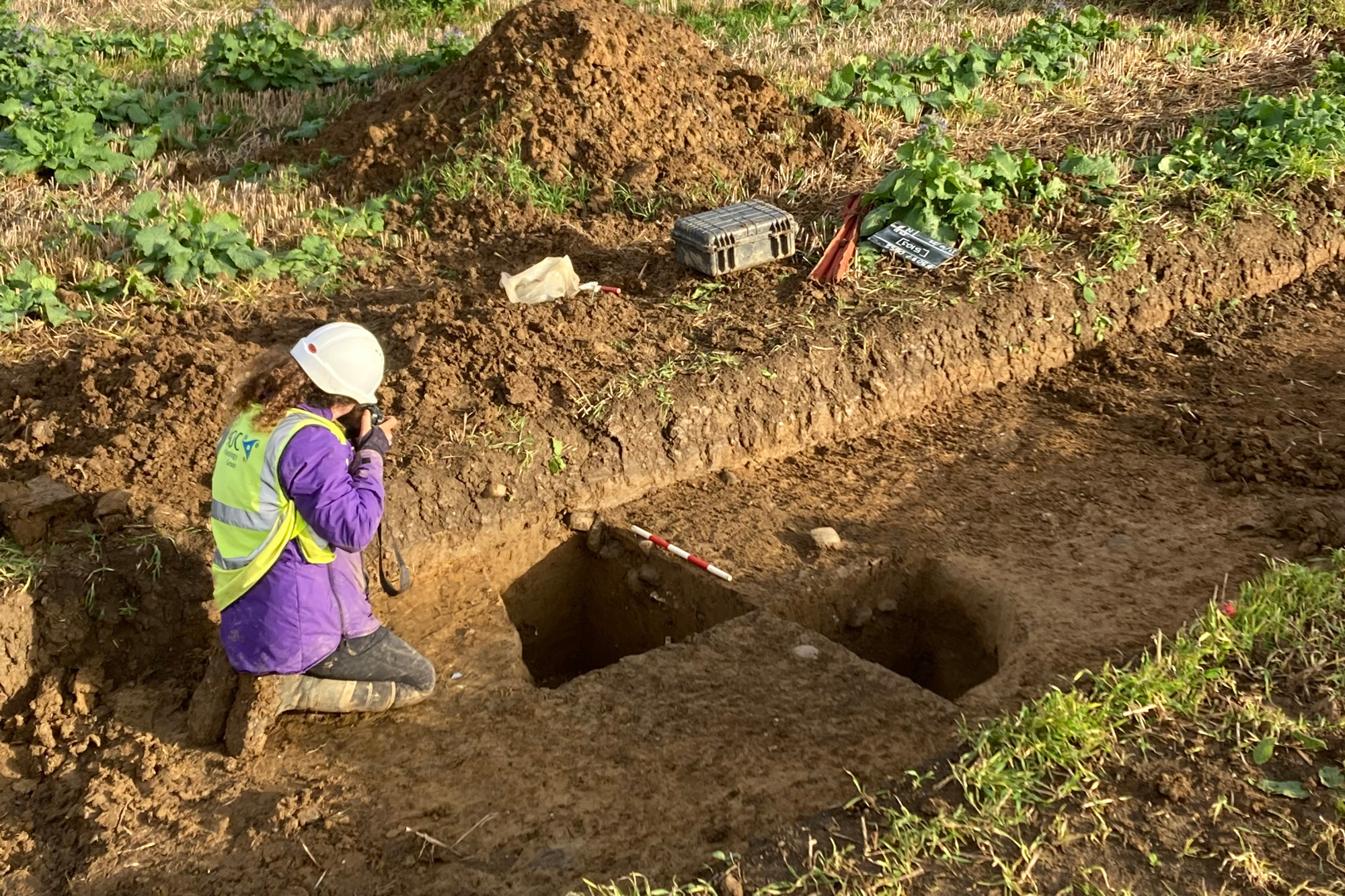
The most substantial medieval remains so far were recorded at Skipsea where a medieval settlement site spanning the 12th to 14th centuries AD was identified.
The time period and location suggest that the settlement could be Cleeton which was recorded in the Domesday Book but presumed lost to the sea due to coastal erosion.
The settlement consists of a nearly-rectangular boundary ditch enclosing a large area with internal boundaries and pits, post holes and ring ditches. Finds from the ditches include daub (indicating there were structures made from wattle and daub), domestic pottery, animal bone and burnt food waste.
Cleeton was thought to have been significant in the 12th to 13th centuries with people living at the site, cultivating crops (mostly wheat) and vegetables and butchering animals. Evidence suggests that the settlement declined after this period as the importance of Skipsea grew and became a focus. The area that was once Cleeton was used as farmland throughout the later medieval periods right up to the present day.
Arable farming was widespread in Holderness throughout the later medieval period, and ‘ridge and furrow’ remains from medieval ploughing were found extensively at the investigated areas.

A 5th or 6th century AD stone-lined pit, probably used as a hearth, at the site of the proposed converter stations (Bentley).

Recording a deep medieval pit at the suspected ‘Cleeton’ settlement site at the proposed landfall.
Next steps
Information from the archaeological investigations has been incorporated into the DBS project design, helping us minimise impacts on the historic environment. The cable route was adjusted to avoid the most significant archaeological and heritage features including the deserted medieval village at Nunkeeling, and the landfall design now avoids areas of prehistoric and likely Romano-British settlement remains.
Where our activities encounter areas of archaeology, we will use the information gathered from the survey and trial trenching to plan archaeological investigations that will include open area excavations. Our intention is to gather as much information from the archaeological record as possible to share with local communities and beyond.
We will continue to work with AOC, and consult with Historic England and the Humber Archaeological Partnership, to ensure that the archaeological heritage within the onshore development area can be understood and preserved, balancing the need for renewable energy supplies with understanding and protection of our shared history.
Other pages you might be interested in
Current status
Learn more about the stages of examination that DBS will go through
The story so far...
The DBS projects have been through a detailed development phase
Keep in touch
Get in touch and ask questions with our project team